


A wall of dust descended upon Chicago late Friday afternoon, casting the city into an eerie, apocalyptic haze as visibility plummeted to nearly zero.
What began as a typical spring day in the Windy City quickly morphed into a catastrophic weather event, leaving residents dazed and fearful as the urban landscape disappeared beneath a thick veil of dust.
‘I didn’t even know this kind of weather existed in Illinois,’ one confused resident wrote on X, formerly Twitter. ‘I lived there for 18 years and cant remember a single dust storm.’
The phenomenon is believed to be the result of a rare dust storm exacerbated by severe weather patterns from the central US, according to the National Weather Service (NWS).
‘Where did the dust storm come from? Thunderstorms in central Illinois produced a big push of wind (60 to 70 mph) that surged northward into our area,’ the NWS wrote in a statement.
‘As the winds moved over dry farmlands, it collected and suspended dust into the air. We were at the receiving end of that dust.’
By early evening, the sky turned an ominous shade of orange, blocking sunlight and dramatically reducing visibility.


A wall of dust descended upon Chicago late Friday afternoon, casting the city into an eerie, apocalyptic haze as visibility plummeted to nearly zero


What began as a typical spring day in the Windy City quickly morphed into a catastrophic weather event, leaving residents dazed and fearful as the urban landscape disappeared beneath a thick veil of particulate matter
According to the NWS, winds of up to 60 miles per hour were driving the storm bringing visibilities down to near zero.
A ground stop was issued earlier in the evening at O’Hare International Airport as the storm system pummeled the city.
As the storm continued to wreak havoc on the Illinois metro, reports flooded in from across the metropolitan area of people unable to see beyond a few feet, with motorists stranded on highways and residents confined to their homes for safety.
‘Holy moly!!! One minute your breathing, the next minute you’re chewing grit!! It hit and we ran through the house closing windows!’ another user said on Facebook.
‘I was staking my tomatoes outside just before it hit and it was NASTY. Had to immediately take a shower,’ another resident wrote on X.
‘Wildest thing I’ve seen living in the Midwest!’ wrote another.
‘I live in a high rise downtown and I’m worried the windows are going to blow in,’ another added.
‘Earlier I couldn’t see to the end of the block but it’s not as bad now,’ one user wrote on Instagram.


Reports flooded in from across the metropolitan area of people unable to see beyond a few feet, with motorists stranded on highways and residents confined to their homes for safety


According to the NWS, winds of up to 60 miles per hour were driving the storm bringing visibilities down to near zero
The unprecedented event is only the second ‘Dust Storm Warning’ in the NWS’ Chicago office’s history, according to the weather service.
The first was on May 7, 2023, however, that warning was away from the metro area. This was the first Dust Storm Warning that included the city of Chicago.
The unbelievable weather event comes less than 24 hours after powerful storms ripped across the region, knocking out power to more than 150,000 ComEd customers and producing wind gusts above 60 mph and hail as large as two inches in diameter, Fox32Chicago reported.
The Thursday night storm arrived with intense lightning, thunder and powerful winds that uprooted trees, snapped utility poles and caused significant damage across parts of Illinois, Wisconsin, Indiana and Michigan.
As of Friday morning, more than 50,000 customers in the ComEd service area were still without electricity.
In nearby states, the storm’s reach extended into Michigan and Indiana, with widespread damage and additional outages reported.
The NWS issued multiple tornado warnings during the evening and overnight hours, with confirmed touchdowns in central Wisconsin. Damage surveys were underway Friday in parts of Michigan.
In Michigan, some wind gusts exceeded 75 mph, and power outages affected more than 200,000 customers at the peak.


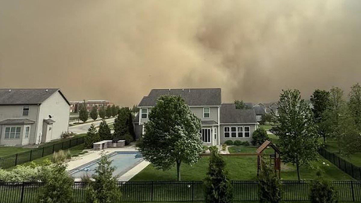
A ground stop was issued earlier in the evening at O’Hare International Airport as the storm system pummeled the city. Pictured: A wall of dust approaches the Illinois suburbs


By early evening, the sky turned an ominous shade of orange, blocking sunlight and dramatically reducing visibility
In Indiana and Michigan alone, more than 30,000 remained without power Friday morning.
Though the dust storm took center stage on Friday, the greater Midwest is facing even more perilous conditions in the coming days.
A wider weather pattern sweeping across the central and eastern US is expected to bring severe thunderstorms, including the possibility of tornadoes, to the Great Lakes region.
The NWS has issued alerts for nearly 200 million people across the region, warning of the heightened risk of destructive winds, large hail, and the potential for life-threatening conditions.
Tornado watches and warnings are likely to be extended as the storm system tracks eastward, threatening cities from Missouri to the East Coast.
As Chicagoans struggle to navigate the perilous conditions, emergency services are bracing for more disruptions.


